Log in
All resources
Create a design
42,491 Free Images of 1900 Maps
fonds ancely - bibliothèque municipale de toulouse - maps
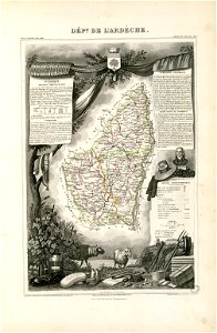
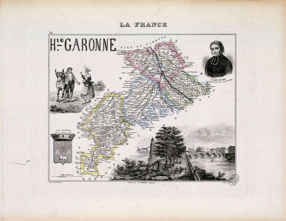
victor levasseur - maps of france
atlas van der hagen
maps made in the 17th century
maps with cartouches
atlantis magni tomus tertius (biblioteca comunale di trento)
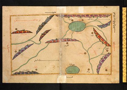
bodleian library
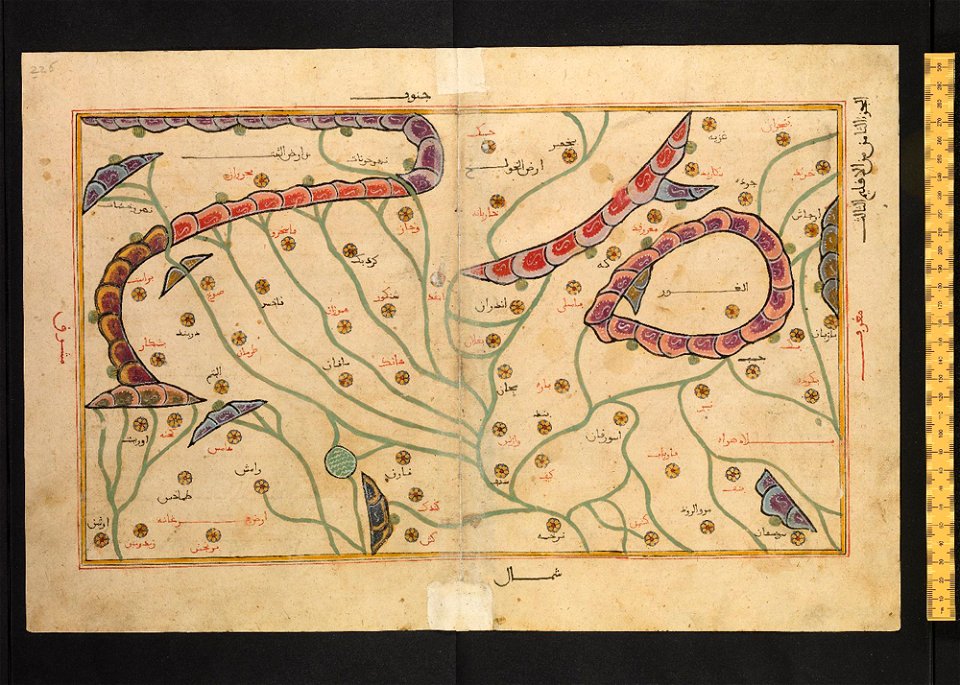
arabic-language manuscripts
files from the bodleian libraries
ms. greaves 42
thomas salmon (historian)
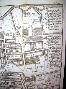
maps of chennai
thomas salmon (historian)
maps of chennai
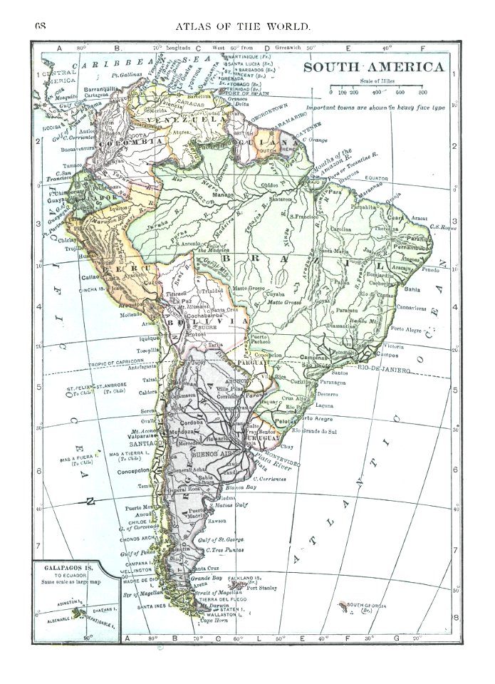
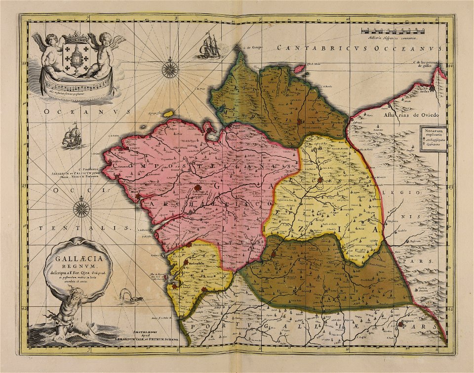
old maps of south america
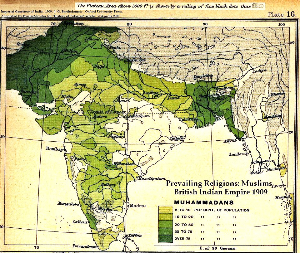
1909
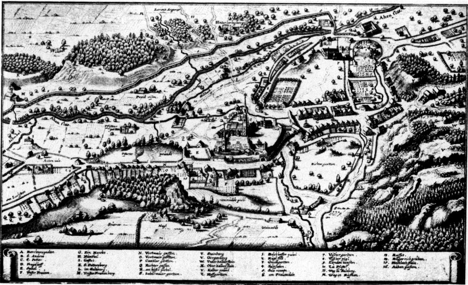
augustinerchorherrenstift berchtesgaden
old maps of berchtesgaden
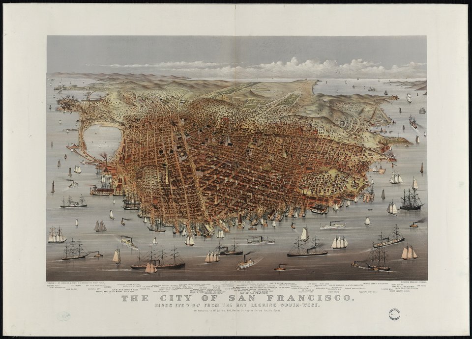
bird's eye view maps of california
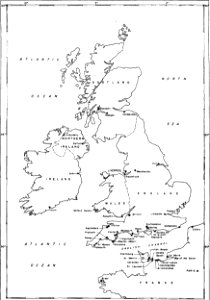
walter cooper dendy
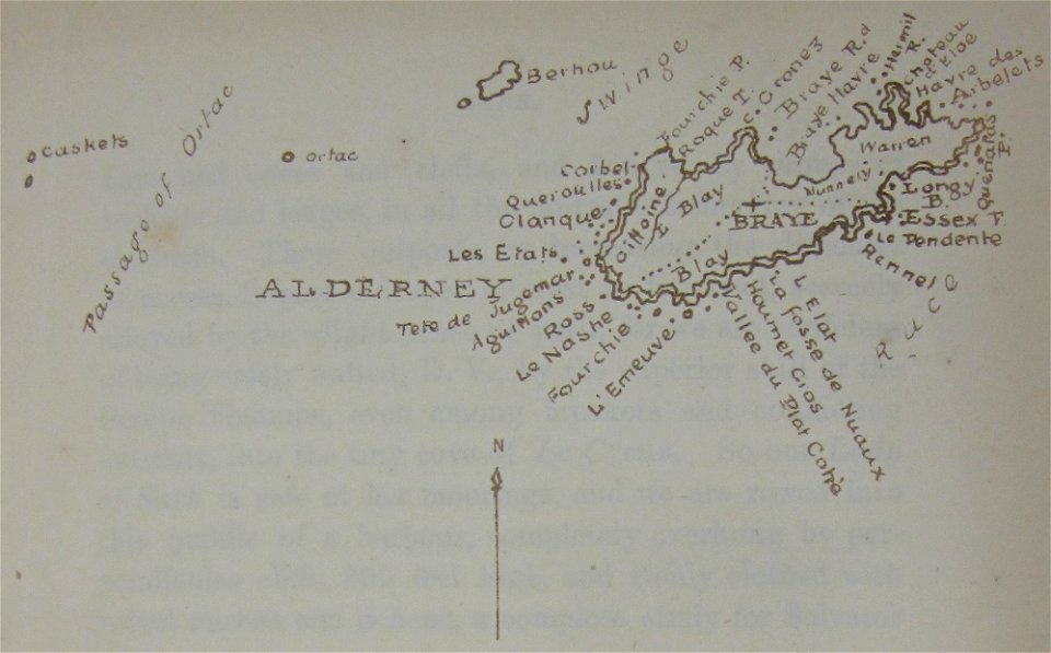
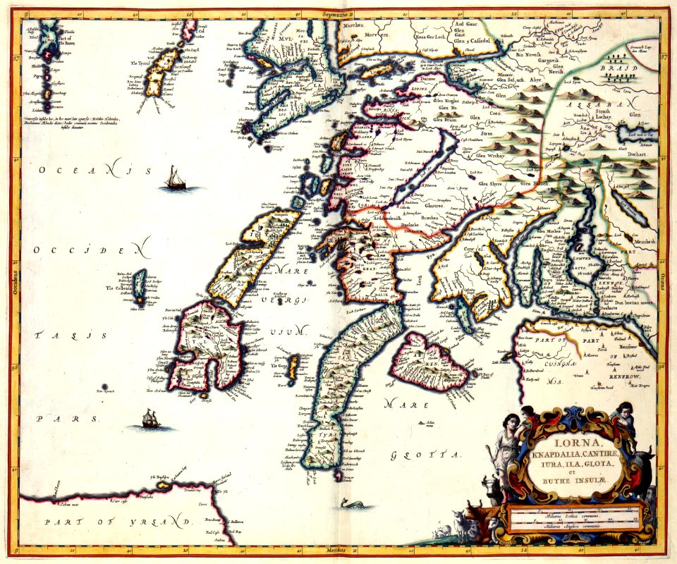
maps of alderney
walter cooper dendy
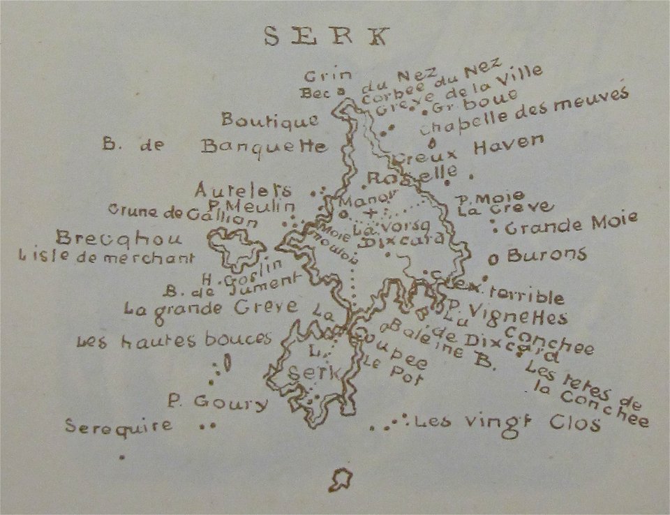
maps of sark
maps of lars kietzlingh
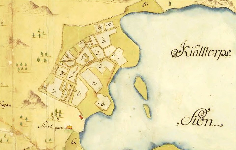
nacka
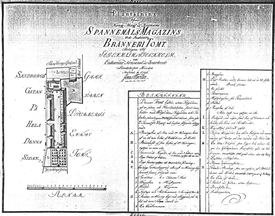
maps by jonas brolin
kvarteret tegen
theatrum urbium (1610)
maps of geneva
maps by willem and johannes blaeu
maps of schwäbisch gmünd
dominikus debler
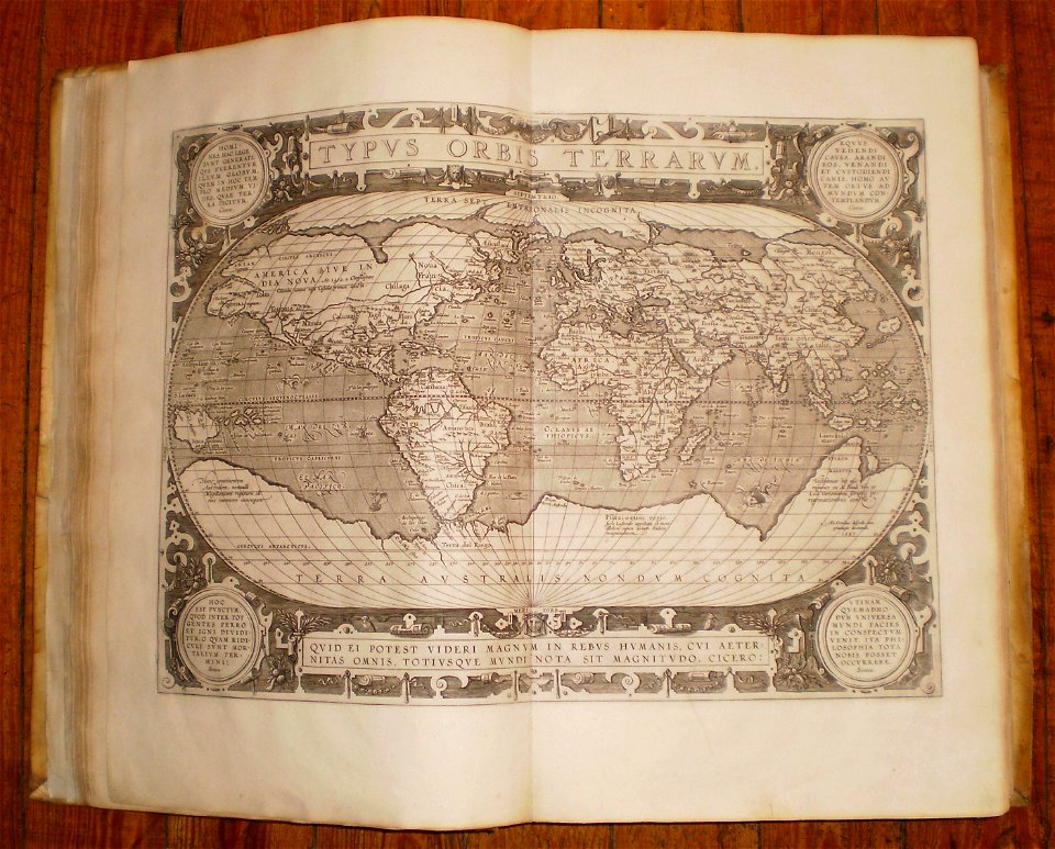
16th-century maps of the world
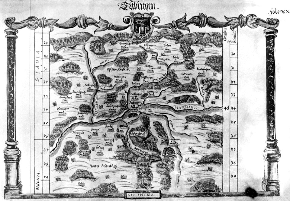
maps of tübingen
1575 in tübingen
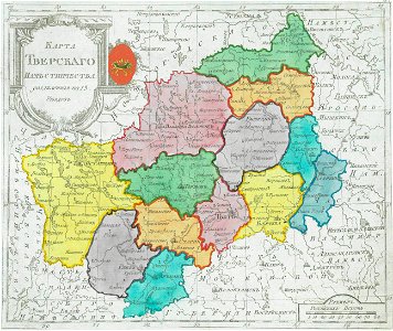
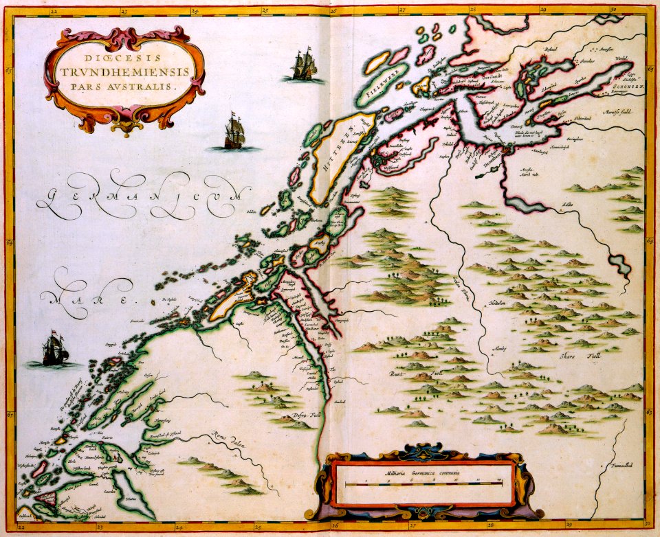
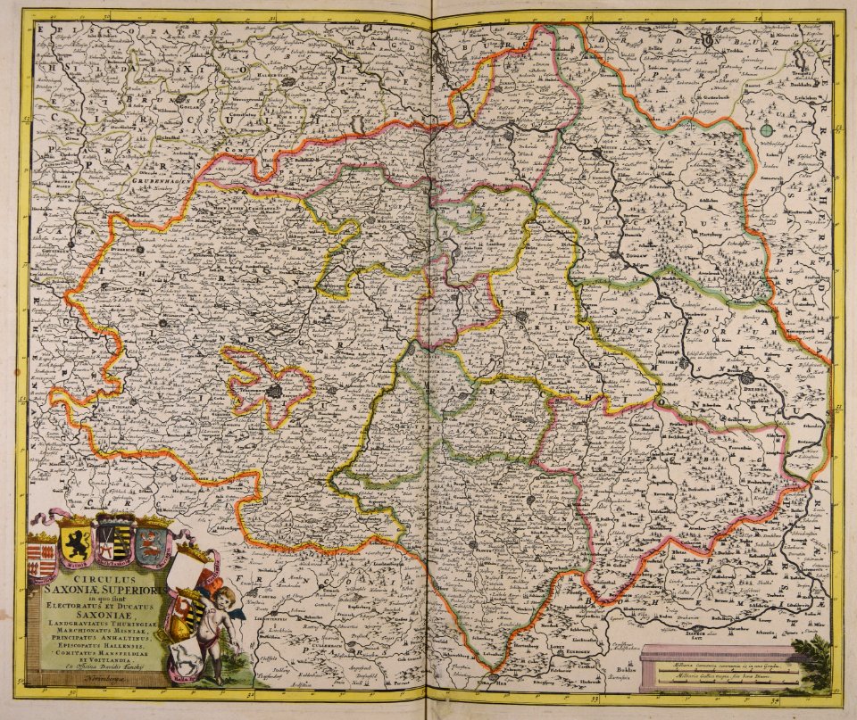
maps of tver governorate
tver viceroyalty
constellations in art
old celestial maps
old maps of the caspian sea
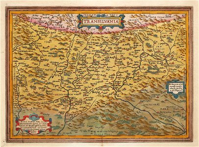
1575 maps of transylvania
johannes sambucus
old maps of ancient rome (city)
itinerario (jan huygen van linschoten)
latin-language maps
maps by frederick de wit
trier see coat of arms
old maps of the canton of zürich
old maps of switzerland
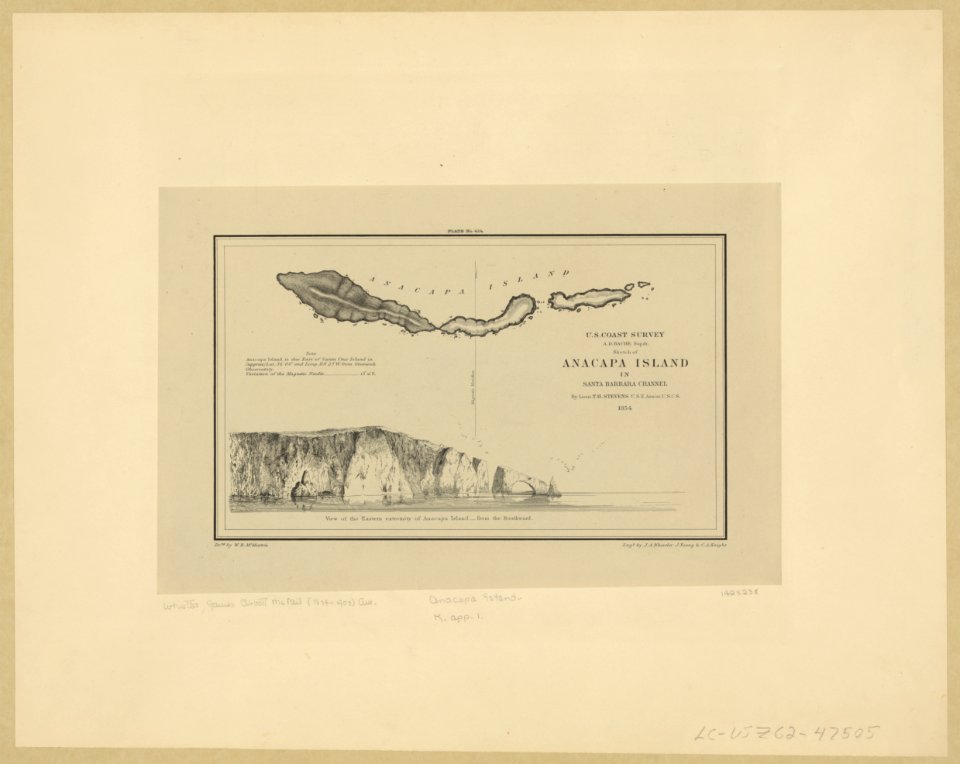
anacapa island
california
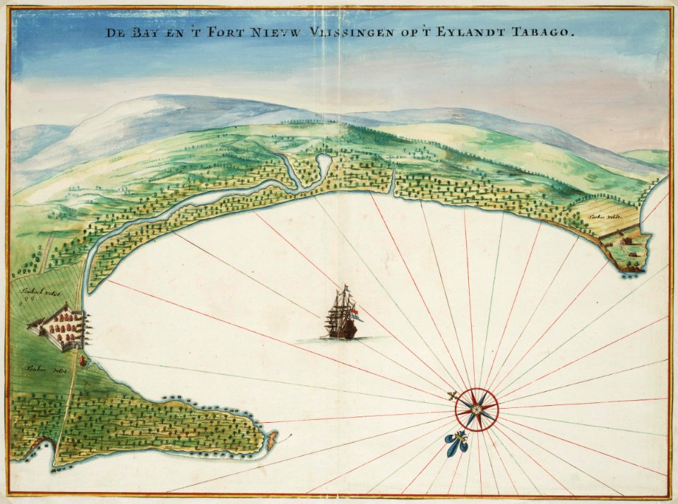
tobago
1665
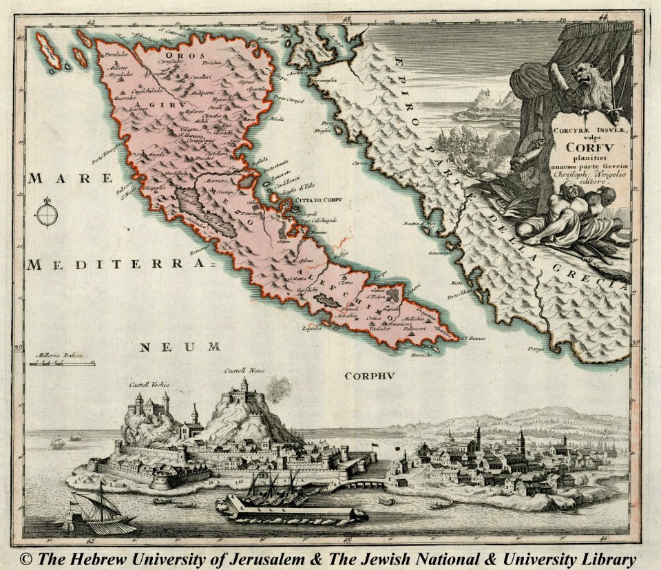
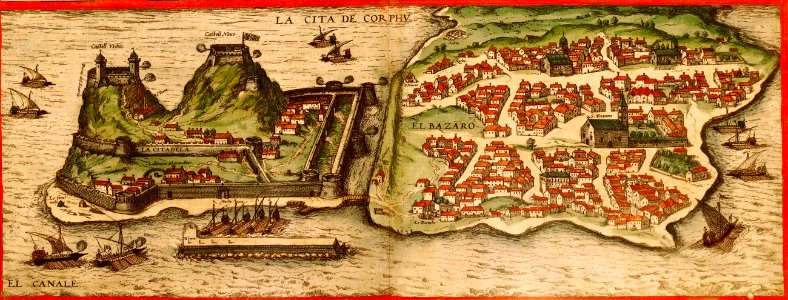
engravings of palaio frourio (corfu)
1720 maps
fonds ancely - bibliothèque municipale de toulouse - maps
frédéric-auguste laguillermie
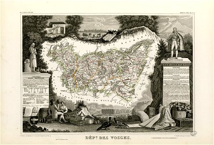
coats of arms of cities in vosges
claude-victor perrin
françois-antoine de boissy d'anglas
frédéric-auguste laguillermie
fonds ancely - bibliothèque municipale de toulouse - maps
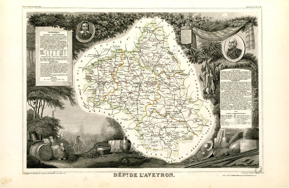
coats of arms of cities in aveyron
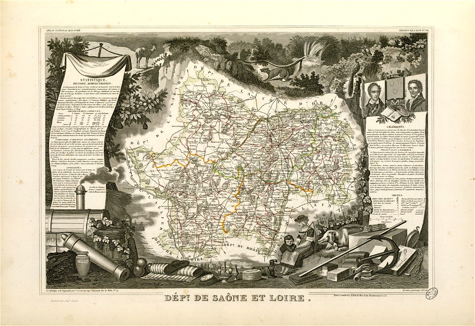
coats of arms of chalon-sur-saône
alphonse de lamartine
coats of arms of cities in hautes-pyrénées
bertrand barère de vieuzac
coats of arms of cities in jura (department)
charles pichegru
maps made in the 17th century
gerard valck
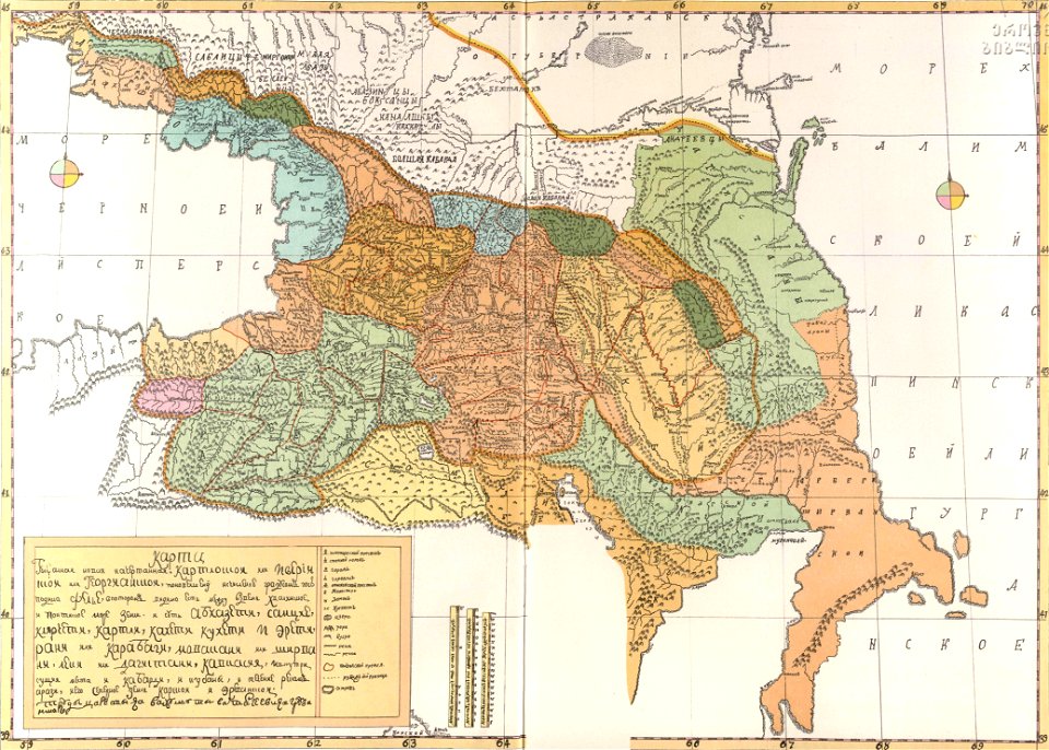
old maps of governorates of the russian empire
old maps of viceroyalty of the caucasus
old maps of the indian subcontinent
dominion of india
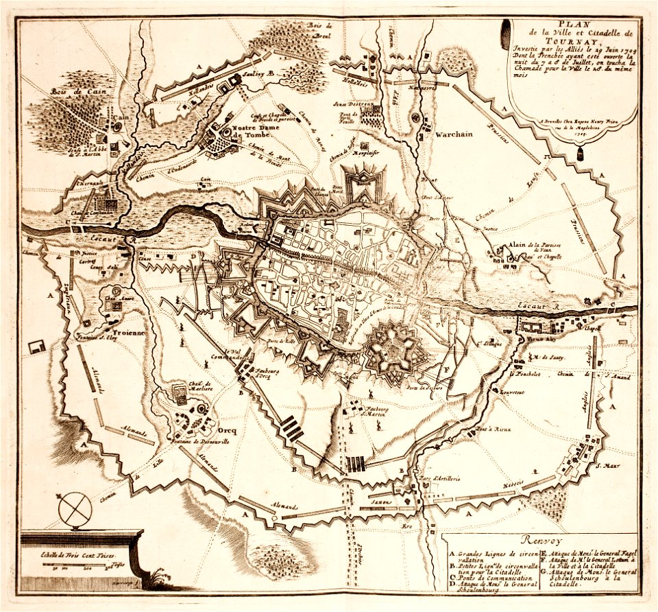
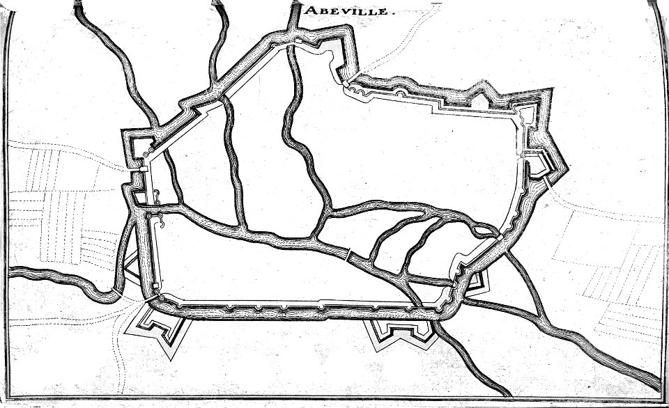
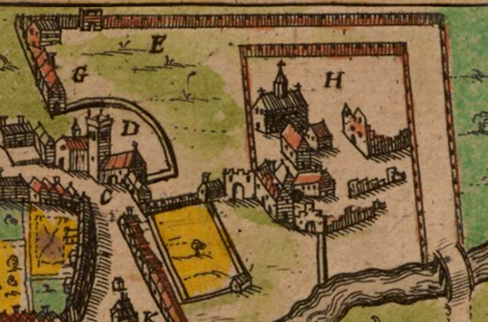
maps of tournai city walls
old maps of tournai
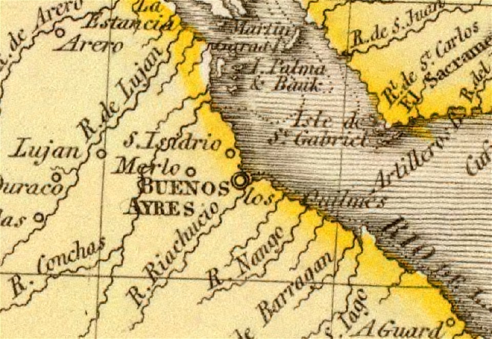
old maps of the río de la plata
1812 maps
fonds ancely - bibliothèque municipale de toulouse - maps
roch-ambroise cucurron sicard
maps made in the 18th century
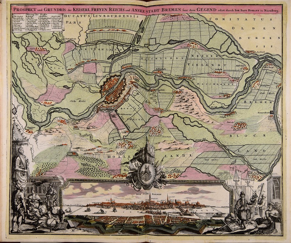
johann baptist homann
18th-century maps of brazil
1780 in south america
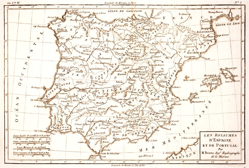
1780s maps of portugal
1780s maps of spain
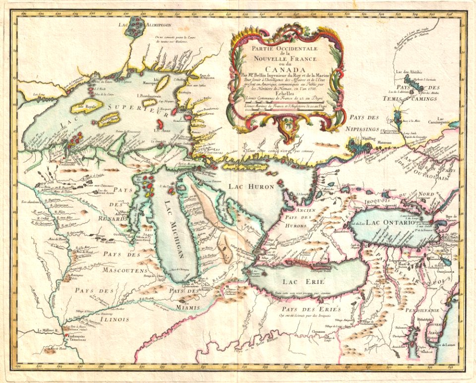
iroquois
ontario
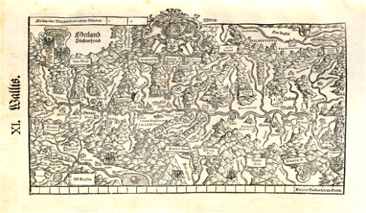
maps made in the 16th century
old maps of switzerland
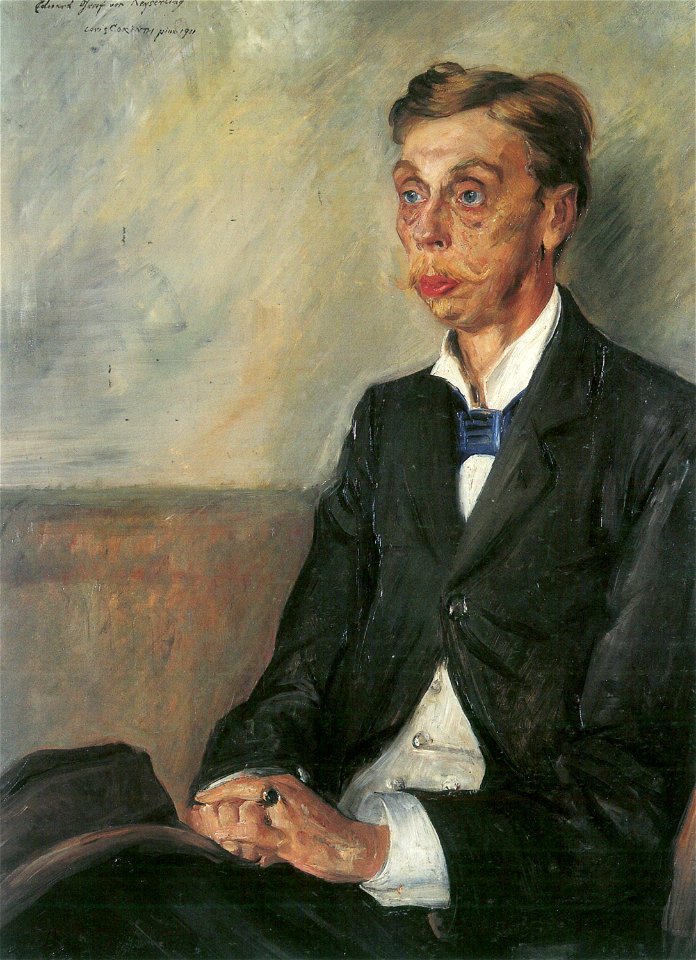
portrait paintings by lovis corinth
lovis corinth
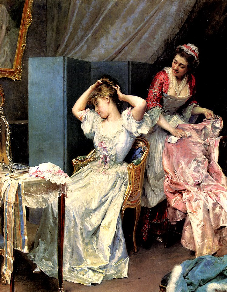
dressing table
maid
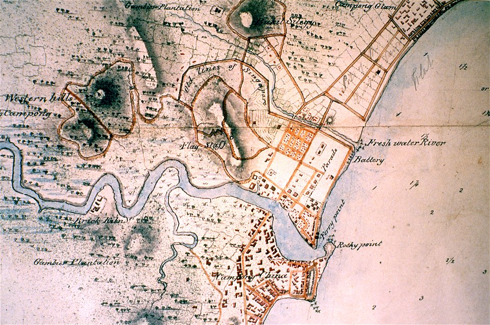
singapore river
singapore
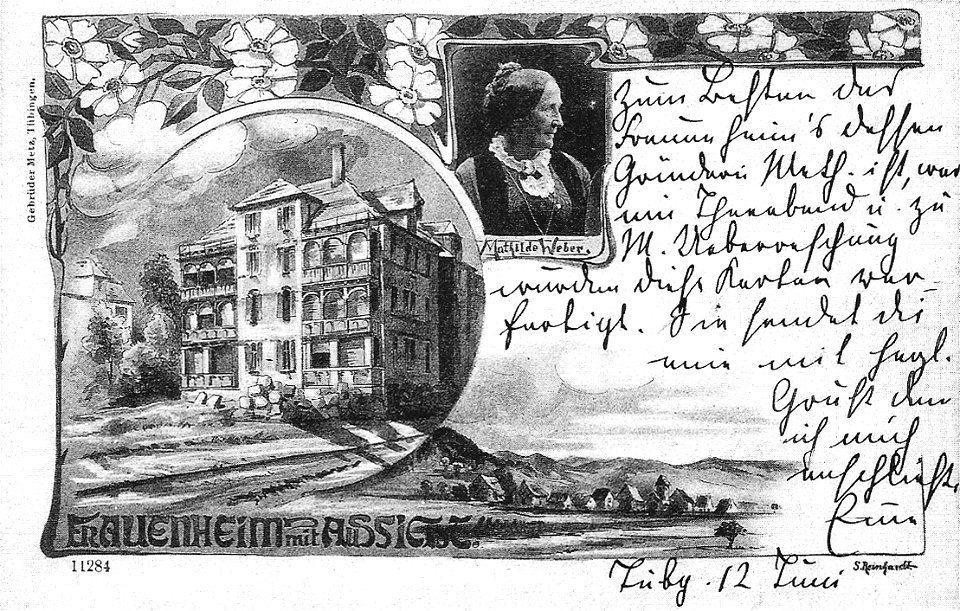
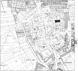
hechinger straße (tübingen)
1900 in tübingen
1900s paintings in unidentified private collections
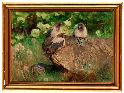
frame painting
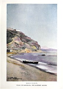
blanco y negro
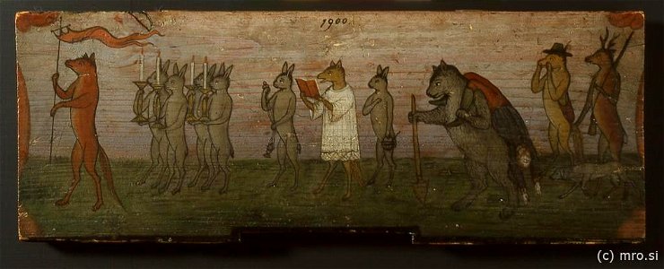
1900
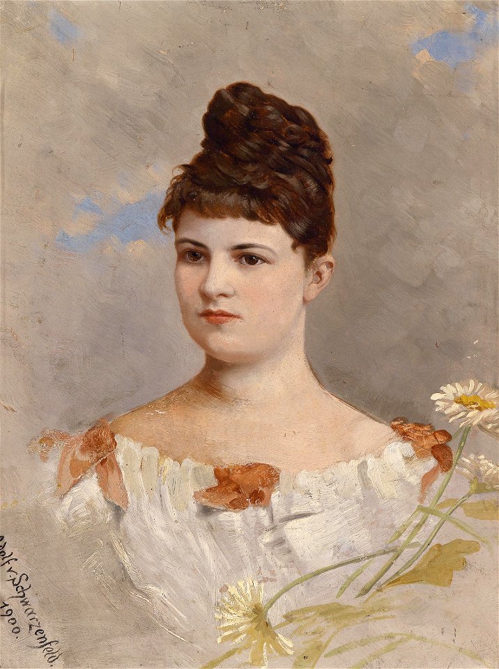
female
1900
portrait paintings of women with flowers
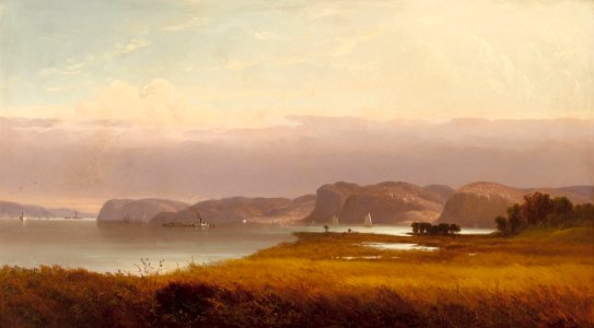
19th-century oil on panel paintings
list of hudson river school artists
1871 paintings
fur fashion in 1900
muffs in art
royal dutch east indies army in art
1900 in art
jasminum in art
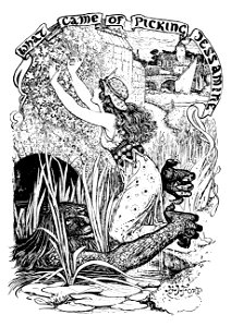
ogre
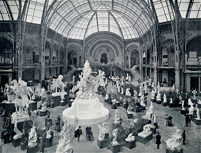
grand palais des beaux-arts de l'exposition universelle (1900)
historical images of the grand palais
20th-century oil on panel paintings in slovenia
radovljica
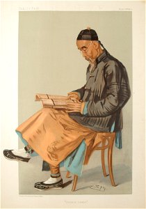
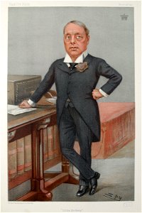
caricatures by leslie ward in vanity fair
people of beijing
20th-century oil portraits of standing women at full length
1900 paintings
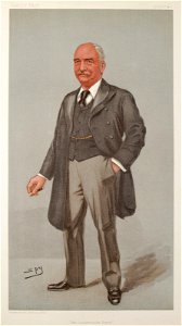
members of the conservative party of the united kingdom
vanity fair caricatures (politicians)
black and white photographs of france
1900 photographs of paris
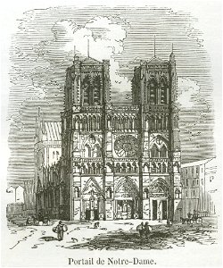
engravings of notre-dame de paris
notre-dame de paris in the 1850s
5th earl of rosebery
little bo peep
20th-century paintings in the nasjonalmuseet for kunst
arkitektur og design
20th-century paintings in the nasjonalmuseet for kunst
arkitektur og design
oil on canvas paintings in the russian museum
landscapes in the russian museum
description of kingdom of georgia
its habits and canons
historic views of konstanz
bishopric of constance
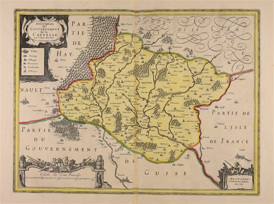
bibliothèque municipale de reims
rès. g 152
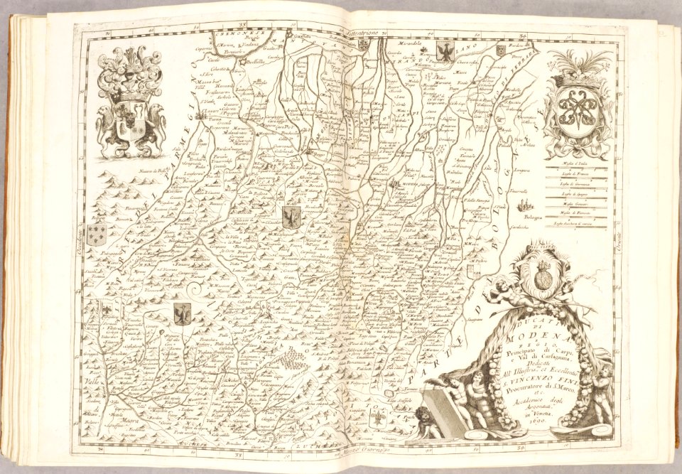
maps of duchy of modena and reggio
modena
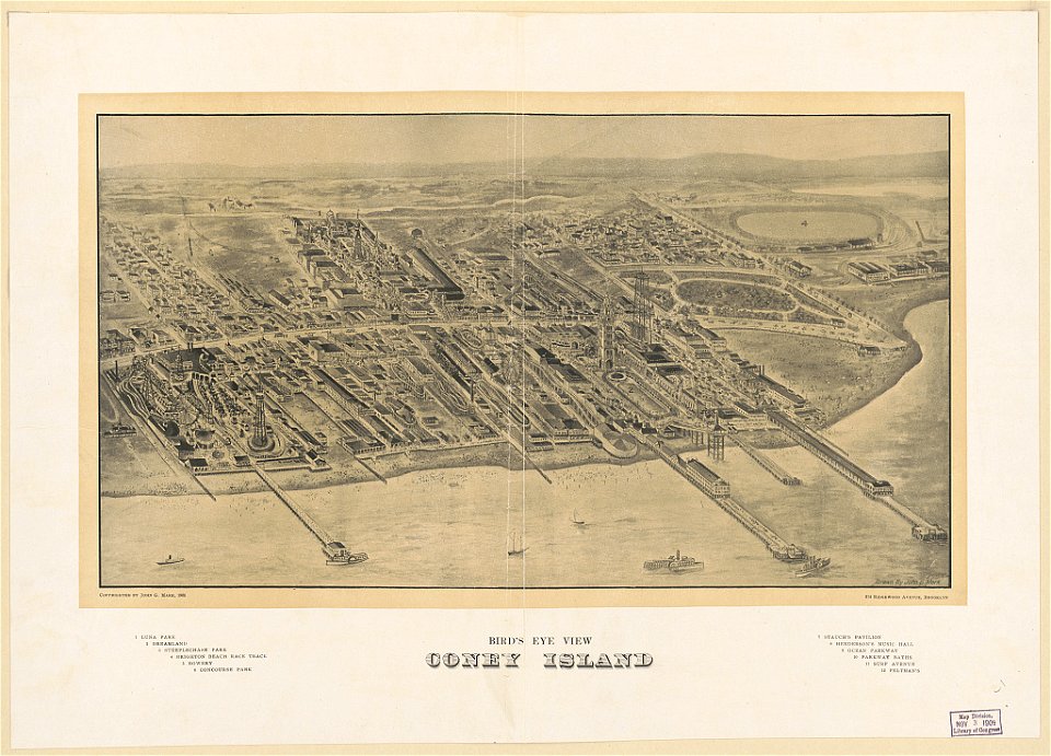
coney island
brooklyn
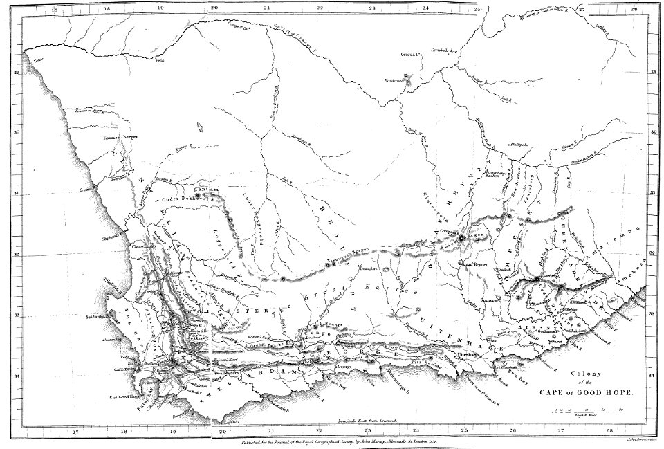
maps of rivers of south africa
mountains of south africa
atlantis magni tomus tertius (biblioteca comunale di trento)
maps made in the 17th century
atlantis magni tomus quintus (biblioteca comunale di trento)
maps made in the 17th century
17th-century maps of the americas
maps with cartouches
old maps of north rhine-westphalia
maps with cartouches
copper engraving
ships on maps
maps with cartouches
atlas van der hagen
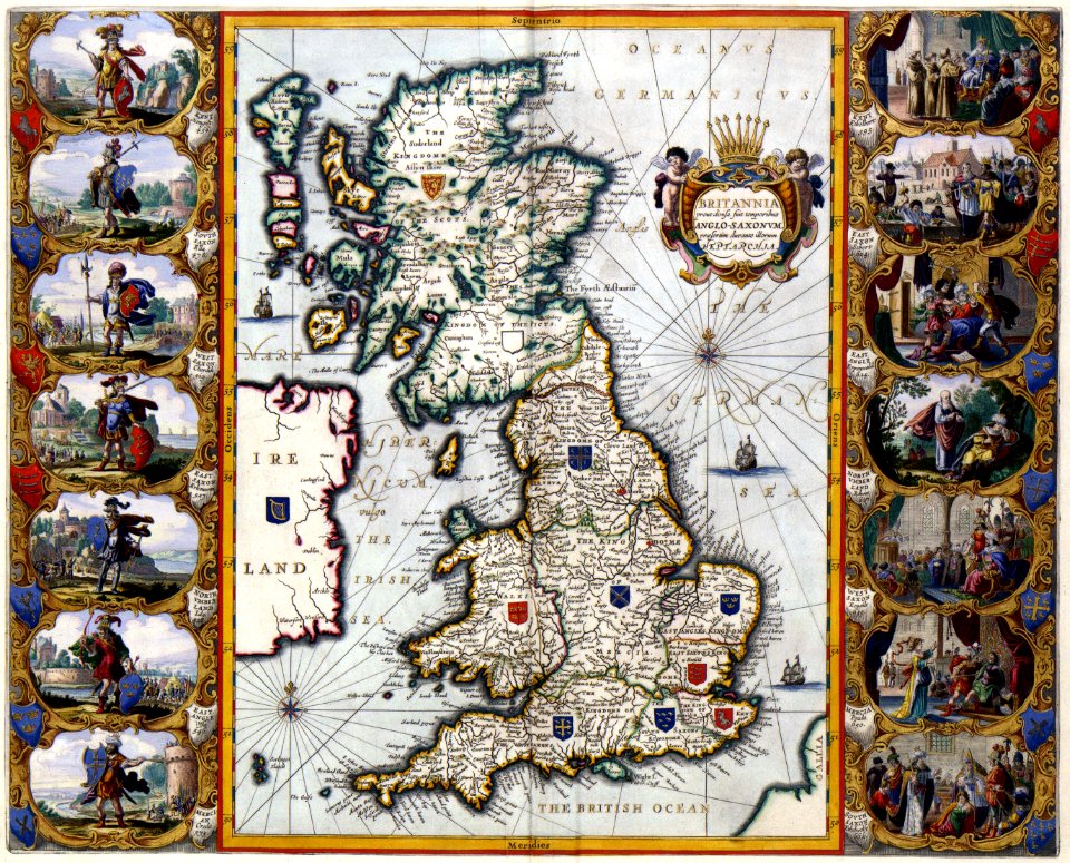
old maps of the british isles
maps with cartouches
atlas van der hagen
old maps of france
maps with cartouches
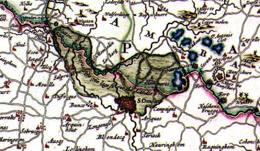
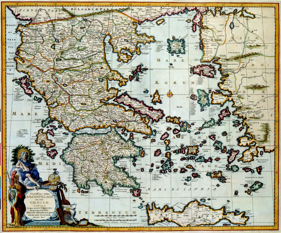
old maps of greece
maps of reading abbey
reading
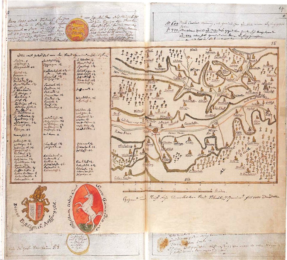
historical images of brackenheim
1835 maps
maps of the dutch east india company - indonesia
banda islands
maps of the west-indische compagnie
1745
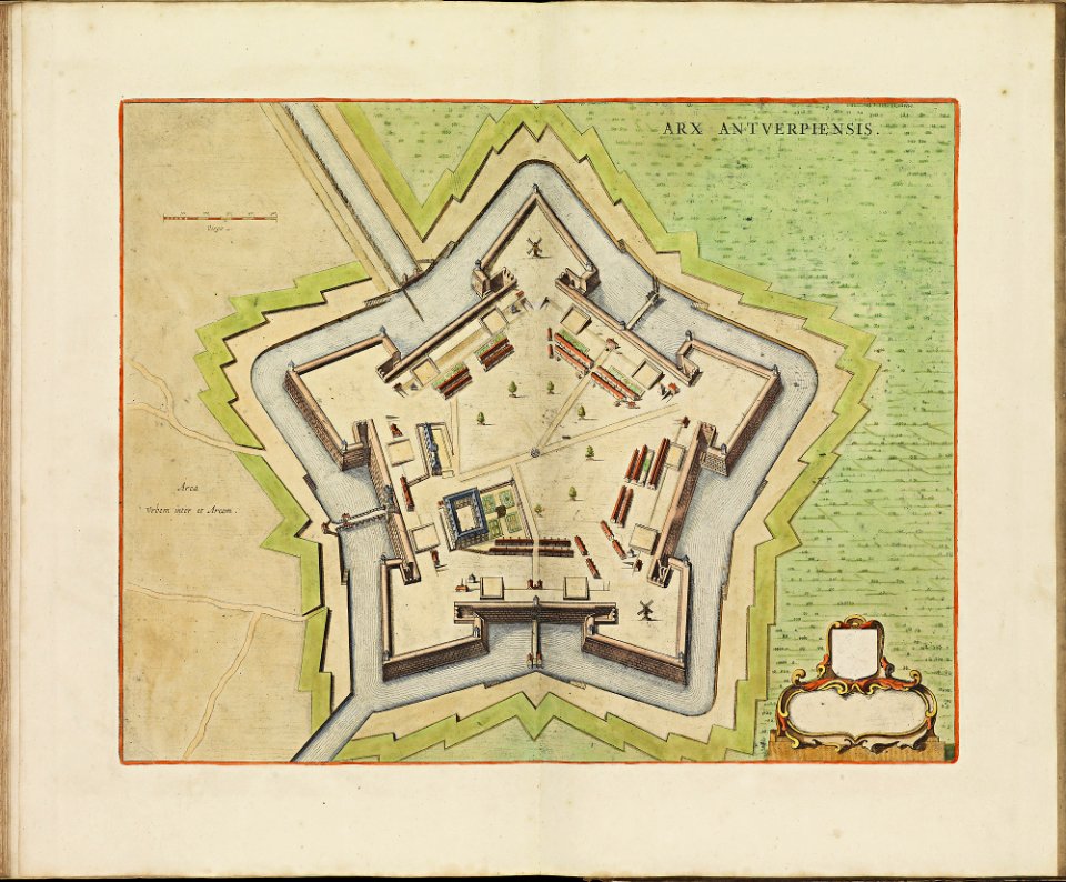
maps of antwerp city walls
frederick de wit
atlantis magni tomus tertius (biblioteca comunale di trento)
maps made in the 17th century
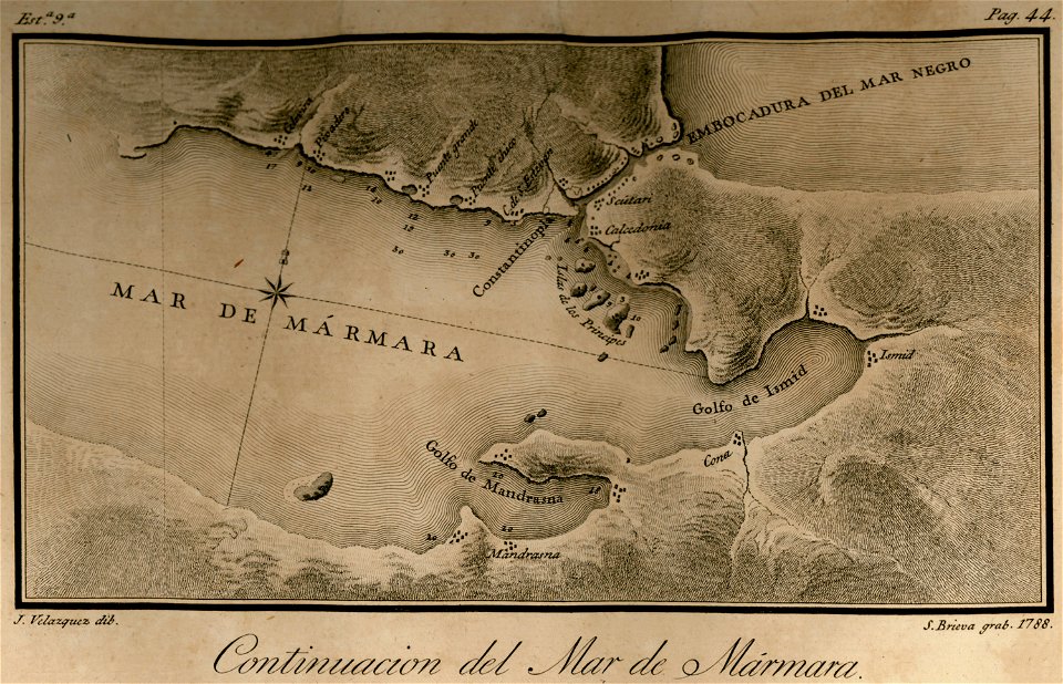
maps of the sea of marmara
maps of the bosphorus
braun & hogenberg
ships on maps
history of lindau (bodensee)
alter rhein
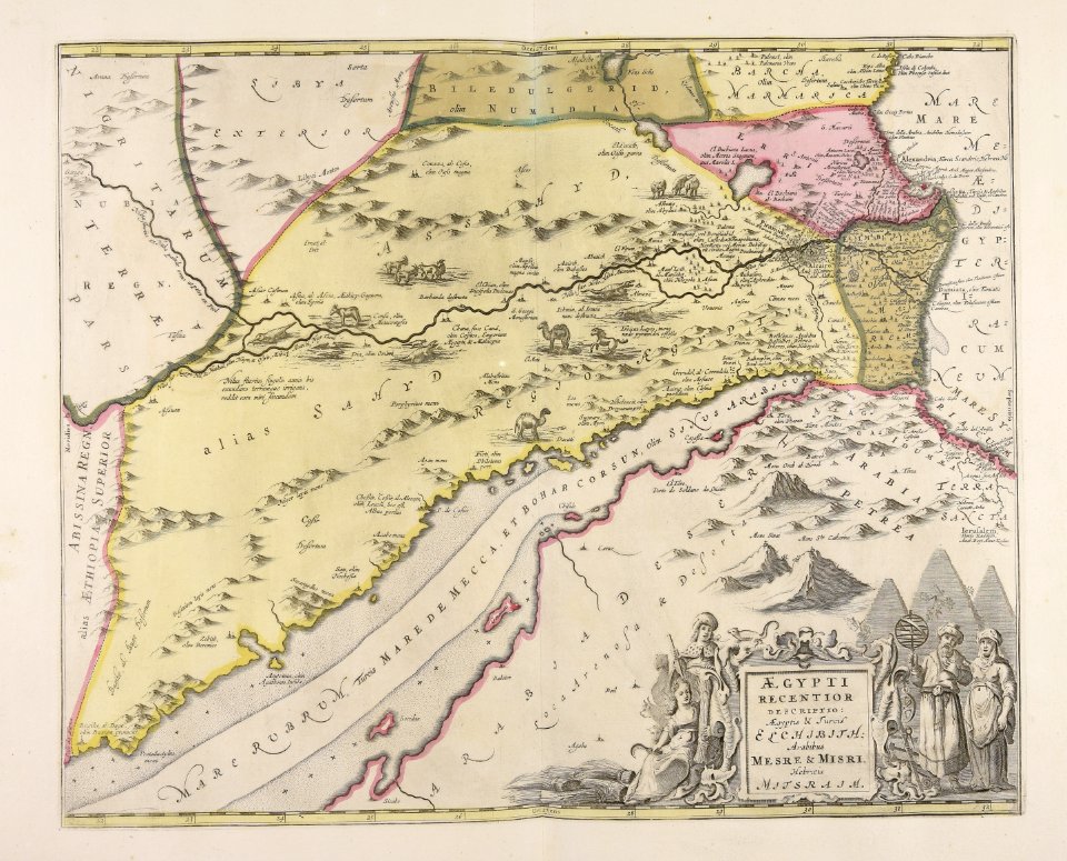
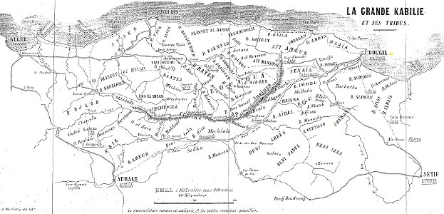
maps of departments of french algeria
maps of kabylie
maps made in the 17th century
jan janssonius
maps made in the 17th century
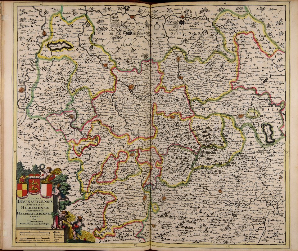
old maps of lower saxony
old maps of china
bodleian library
old maps of tunisia
bodleian library
old maps of turkestan
bodleian library
old maps of turkestan
bodleian library
military bases of the united states
old maps of the history of normandy
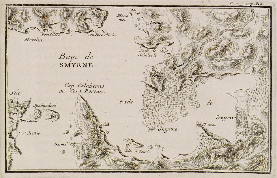
joseph pitton de tournefort
i̇zmir in the 18th century
maps made in the 18th century
gerard valck
8101 - 8200 of 42,491
Next page
/ 425